Civil 3D – Civil Infrastructure Software | Autodesk
Autodesk Civil 3D is a solution for civil and urban engineers to design different infrastructure projects and manage all construction stages from coordination to implementation and analysis. This software supports BIM (Building Information Modeling) and contains integrated features that improve drafting, design, and construction documentation.
Advantages of using Autodesk Civil 3D:
- Suitable user environment with the ability to be optimized and customized
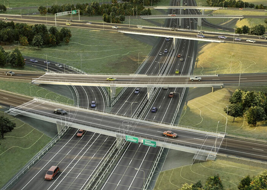
- Design and construction of various roads, passages, tunnels and other parts of construction projects
- Having a ready and standard database of various components of construction projects
- Carrying out various types of surveys and geological and geographical analyzes
- Ability to work as a group and share and update project implementation information
- Has the facilities to design the route of oil and gas pipes
- Ability to three-dimensional project stages to better understand and visualize and make the necessary modifications and optimizations
- Having the mapping features of AutoCAD Map 3D software
- Support for GPS tools and the use of their location information
- Increase speed and accuracy and also reduce the cost of projects
History of Autodesk Civil 3D
As with many Autodesk products, Civil 3D began life elsewhere. The software was originally developed as an AutoCAD add-on by a company in New Hampshire called Softdesk (originally DCA). Softdesk was acquired by Autodesk, and Civil 3D was further evolved.
Civil 3D is designed to give engineers a way to use design standards throughout the design process. It’s also great at automating the process of creating production deliverables and reducing the time needed to react to changes as projects progress.
Dan Simeone Product Manager at Autodesk explains: “We chose AutoCAD as our foundation because the need to deliver 2D submittal documents was absolutely critical and we didn’t see this changing in the near term. And because civil engineering projects are typically built on actual real-world locations, we opted to build on the functionality of AutoCAD Map 3D.
We also worked closely with the AutoCAD Architecture team to leverage a common object modeling system that allowed us to quickly implement modeling paradigms including 2D/3D object display, modeling relationships and more.”
Simeone admits that in its infancy, Civil 3D didn’t have the critical workflows it has today. With each release (Civil 3D is updated each year), the software evolved. For example, during years 5-6 it was “all about filling in the big functional areas… think surfaces, corridor models and section sheets,” explained Simeone. Early on, as customers transitioned from AutoCAD Land Desktop (essentially Civil’s predecessor) product development was focused on helping customers make the move at a pace that was right for them. It wasn’t until 2009-2010 that the transition reached a tipping point and “product maturity reached a point where customers could make the switch to Civil 3D for full scale production” explained Simeone.
Civil 3D adoption was a challenge for many, so rather a big focus in product development was ensuring easier adoption, rather than filling in workflow gaps.
“The emphasis was more about product stability, performance, and general fit in an organization. For example, we opted to hold the object version starting with R2013 which nearly eliminated the most common adoption and coordination challenge reported by our customers.”